Zeitpunkt              Nutzer    Delta   Tröts        TNR     Titel                     Version  maxTL
Sa 20.07.2024 00:00:03   191.470       0    9.231.235    48,2 Mastodon                  4.3.0...   500
Fr 19.07.2024 13:57:40   191.470      -7    9.224.706    48,2 Mastodon                  4.3.0...   500
Do 18.07.2024 00:00:04   191.477      -2    9.210.826    48,1 Mastodon                  4.3.0...   500
Mi 17.07.2024 00:00:03   191.479     -29    9.202.399    48,1 Mastodon                  4.3.0...   500
Di 16.07.2024 00:00:04   191.508      -2    9.192.694    48,0 Mastodon                  4.3.0...   500
Mo 15.07.2024 00:00:04   191.510       0    9.184.201    48,0 Mastodon                  4.3.0...   500
So 14.07.2024 00:00:01   191.510      -5    9.175.810    47,9 Mastodon                  4.3.0...   500
Sa 13.07.2024 00:00:02   191.515      -3    9.169.050    47,9 Mastodon                  4.3.0...   500
Fr 12.07.2024 00:00:29   191.518      -2    9.159.911    47,8 Mastodon                  4.3.0...   500
Do 11.07.2024 00:00:00   191.520       0    9.151.853    47,8 Mastodon                  4.3.0...   500
Dismal Manor Gang (@DismalManorGang) · 04/2022 · Tröts: 4.125 · Folger: 500
Sa 20.07.2024 11:36
#NWSWakefieldVA writes …
“Locally heavy rainfall is possible into this evening. Where the heaviest rain falls, areas of flash flooding are possible.
A few strong to severe storms are possible this afternoon and evening with strong straight line winds and locally heavy rainfall.”
Tornadoes are unlikely but possible in isolated supercell thunderstorms should they develop.

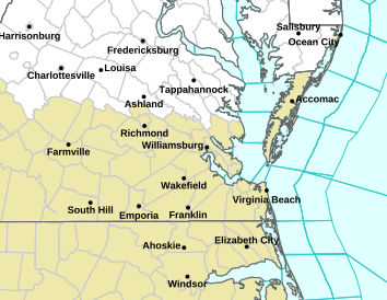
Saturday’s weather hazards map for scattered thunderstorms with locally heavy downpours. Some thunderstorms may be severe (wind and hail hazards). Flash flooding was not mentioned but is possible if slow moving or training storms occur. The frontal boundary is occluded and storms are likely to travel along it.

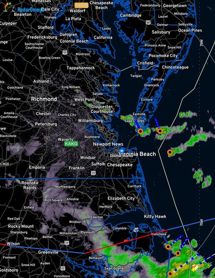
The 0515Q radar is quiet. The occluded front is south of Kitty Hawk. Two overnight storms are near Cape Charles

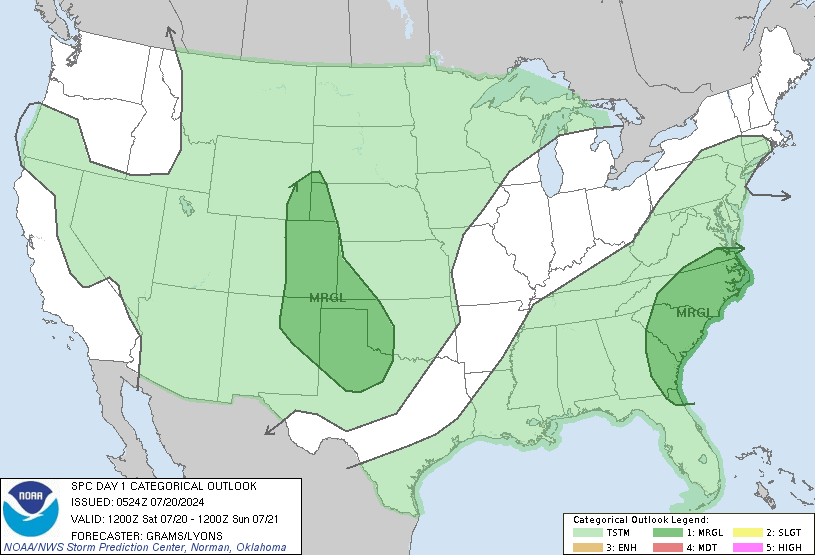
Saturday’s thunderstorm forecast indicates conditions conducive to thunderstorms are present in most of the Great Plains, Gulf Coast, and Atlantic Coast from Cape Cod south. Virginia, NC and SC coastal plains are somewhat more likely to have severe storms.
[Öffentlich] Antw.: 0 Wtrl.: 0 Fav.: 0 · via Ivory for iOS