Zeitpunkt              Nutzer    Delta   Tröts        TNR     Titel                     Version  maxTL
Di 30.07.2024 00:00:03   191.322      -8    9.327.492    48,8 Mastodon                  4.3.0...   500
Mo 29.07.2024 00:00:00   191.330      -1    9.318.622    48,7 Mastodon                  4.3.0...   500
So 28.07.2024 00:00:03   191.331       0    9.309.563    48,7 Mastodon                  4.3.0...   500
Sa 27.07.2024 00:00:04   191.331       0    9.300.691    48,6 Mastodon                  4.3.0...   500
Fr 26.07.2024 00:00:03   191.331      -1    9.290.684    48,6 Mastodon                  4.3.0...   500
Do 25.07.2024 00:00:01   191.332      -2    9.280.821    48,5 Mastodon                  4.3.0...   500
Mi 24.07.2024 00:00:01   191.334     -76    9.270.150    48,5 Mastodon                  4.3.0...   500
Di 23.07.2024 00:00:02   191.410     -56    9.260.118    48,4 Mastodon                  4.3.0...   500
Mo 22.07.2024 00:00:05   191.466      -2    9.249.533    48,3 Mastodon                  4.3.0...   500
So 21.07.2024 00:00:02   191.468       0    9.240.281    48,3 Mastodon                  4.3.0...   500
Dismal Manor Gang (@DismalManorGang) · 04/2022 · Tröts: 4.092 · Folger: 504
Di 30.07.2024 12:47
Dismal Manor Ganf awoke at dawn and walked on down the hall …
Greyhounds have been out for a dash and splash. And right back in as the #Fugly threatened to take them. 22C with 20 C dew point and some virga down.
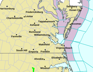
Today’s weather hazards are rip currents at ocean beaches and small craft advisories An unhealthy heat watch is up for hot weather expected Wednesday and beyond.
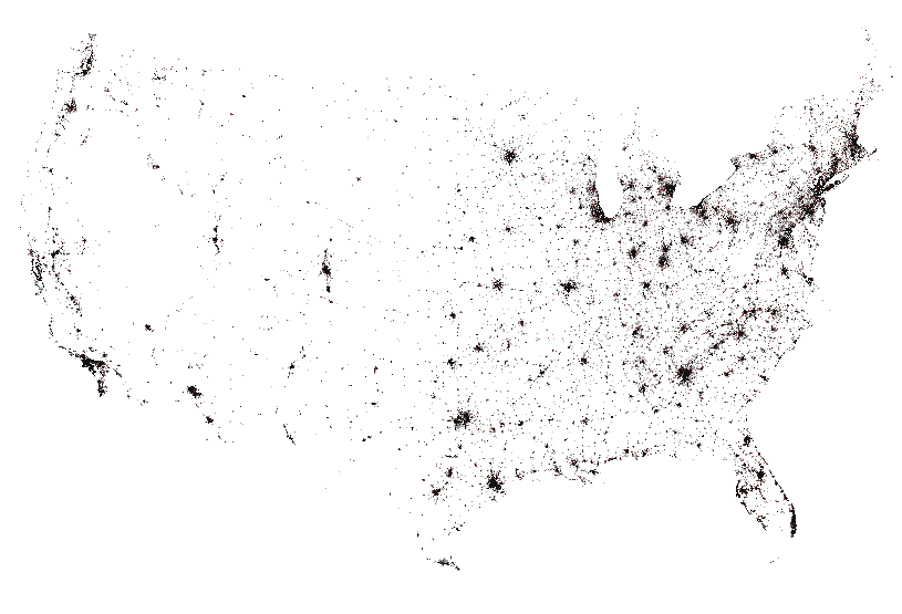
The fly spec plot is where one of the operational models expects rain. It goes with the severe weather plot.

Heat coming Wednesday. Small craft advisory and ocean beach rip current advisory.

Flyspec plot of likely thunderstorm locations. Note a thick stretch from northern Virginia to Boston suggests development of a mesoscale linear convective system strum und drang indicated.

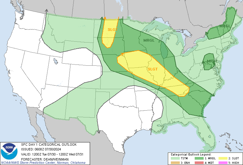
And the thunderstorm map. Scattered thunderstorms east of the Mississippi River with a patch of probable severe thunderstorms from Omaha #NE and across #IA northern #MIssouri much of #IL and stretches into northwest #SC.

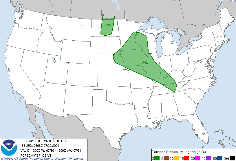
Eastern #Nebraska, #IL, western #WV, and eastern #TN under a 2% probability of a tornado within 25 miles of any point in the shaded area. Early isolated supercells pose greatest risk.
[Öffentlich] Antw.: 0 Wtrl.: 0 Fav.: 0 · via Ivory for iOS