Zeitpunkt              Nutzer    Delta   Tröts        TNR     Titel                     Version  maxTL
Sa 13.07.2024 00:00:08    61.948      +1    3.539.632    57,1 Fosstodon                 4.2.10     500
Fr 12.07.2024 00:01:45    61.947      +6    3.537.376    57,1 Fosstodon                 4.2.10     500
Do 11.07.2024 00:00:37    61.941     +12    3.533.951    57,1 Fosstodon                 4.2.10     500
Mi 10.07.2024 00:00:53    61.929      +5    3.530.507    57,0 Fosstodon                 4.2.10     500
Di 09.07.2024 00:00:08    61.924      +2    3.527.175    57,0 Fosstodon                 4.2.10     500
Mo 08.07.2024 00:00:19    61.922      +5    3.524.369    56,9 Fosstodon                 4.2.10     500
So 07.07.2024 00:00:04    61.917       0    3.522.885    56,9 Fosstodon                 4.2.10     500
Sa 06.07.2024 00:00:07    61.917      -2    3.523.632    56,9 Fosstodon                 4.2.10     500
Fr 05.07.2024 00:00:27    61.919       0    3.520.710    56,9 Fosstodon                 4.2.10     500
Do 04.07.2024 00:00:52    61.919       0    3.517.337    56,8 Fosstodon                 4.2.9      500
Eric Matthes (@ehmatthes) · 11/2022 · Tröts: 1.456 · Folger: 488
Sa 13.07.2024 23:13
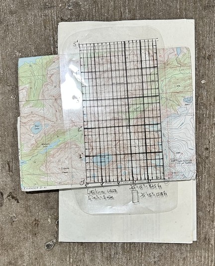
Before reliable handheld GPS units with decent screens were a thing, a few of us made our own grid overlays for use with paper USGS maps. You could read a lat/long from a text-only GPS, and use the overlay to figure out exactly where you were on the map.
I’m happy not to need these anymore, but also quite happy to know how to do this if everything stops working.

Grid drawn on transparency sheet, showing 0.25-minute markings
[Öffentlich] Antw.: 0 Wtrl.: 0 Fav.: 0