Zeitpunkt              Nutzer    Delta   Tröts        TNR     Titel                     Version  maxTL
So 07.07.2024 00:00:04    61.917       0    3.522.885    56,9 Fosstodon                 4.2.10     500
Sa 06.07.2024 00:00:07    61.917      -2    3.523.632    56,9 Fosstodon                 4.2.10     500
Fr 05.07.2024 00:00:27    61.919       0    3.520.710    56,9 Fosstodon                 4.2.10     500
Do 04.07.2024 00:00:52    61.919      +2    3.517.337    56,8 Fosstodon                 4.2.9      500
Mi 03.07.2024 00:00:12    61.917      +2    3.513.906    56,8 Fosstodon                 4.2.9      500
Di 02.07.2024 00:01:44    61.915      -2    3.510.479    56,7 Fosstodon                 4.2.9      500
Mo 01.07.2024 00:00:33    61.917       0    3.507.420    56,6 Fosstodon                 4.2.9      500
So 30.06.2024 00:00:34    61.917      +2    3.504.671    56,6 Fosstodon                 4.2.9      500
Sa 29.06.2024 00:01:13    61.915      +2    3.501.982    56,6 Fosstodon                 4.2.9      500
Fr 28.06.2024 00:01:07    61.913       0    3.498.459    56,5 Fosstodon                 4.2.9      500
OPENGIS.ch (@opengisch) · 09/2023 · Tröts: 54 · Folger: 148
So 07.07.2024 07:16
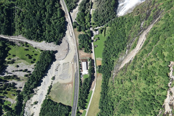
Join the effort to map the floods in Ticino! Download QField Rapid Mapper at https://qfield.app. This mobile app allows emergency responders, civil protection, military, and citizens to quickly assess and report damages from natural disasters. OPENGIS.ch is donating the QFieldCloud infrastructure for real-time data collection and mapping to enhance disaster response in 2024.
https://www.opengis.ch/2024/07/07/qfield-rapid-mapping-ticino/
[Öffentlich] Antw.: 0 Wtrl.: 0 Fav.: 0 · via Buffer